
THE USA EDITION / FIELD NOTES
A clearer view
of the weather.
Radar, warning areas and a quiet soundtrack. Here’s how to read Stormtape’s USA edition without confusing a visualisation with an official warning.
Find the USA stream ↗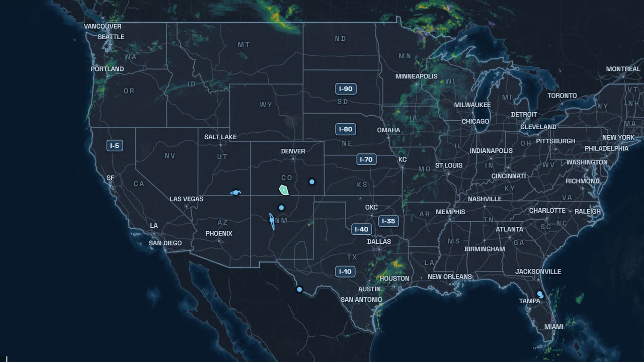
Radar shows echoes, not every weather impact.
The USA edition uses NOAA/NWS MRMS radar mosaics, single-site NEXRAD Level III base reflectivity, radial velocity and storm-track motion vectors (projected +15/+30/+45 min arrival corridors as observational context, not official path warnings), and other individually identified weather layers. Rainfall echoes do not directly measure river level or establish that a location is safe. Flooding can occur away from the place where rain originally fell.
The highlighted warning is the one in focus.
A selected area, its event name and the matching information card belong together. Stormtape selects and redraws NWS alert-source data independently. Colours and outlines support recognition; the event name remains explicit. A watch, a warning and model guidance have different meanings.
Closer map detail is geographic context.
Town names, roads, rivers and buildings help you recognise a location. They do not make radar or warning information accurate to an individual building. Coverage varies. This edition covers the contiguous Lower 48; Alaska, Hawaii, territories and comprehensive marine-alert coverage are outside its scope.
Check the time, then the source.
Weather layers have their own observation or product times. Delayed or unavailable data are labelled; a missing layer is not an all-clear. Use the National Weather Service and local authorities for official guidance. Stormtape is not affiliated with or endorsed by NOAA/NWS.
Weather to watch. Lo-fi to focus.
Calm music supports longer sessions. When enabled, sparse English updates use a synthetic voice that is disclosed in the picture and on the platform. Announcement text is assembled from alert-source data by rules; it is not a generative weather forecast. Automated recorded US recap and short clips present historical weather snapshots with calm music and without synthetic voice narration, visibly marked as archived observations rather than active alerts. How the AI voice is disclosed →
Sources and rights.
Data source: NOAA/NWS. Incorporated U.S. Government weather data and warning text are not subject to copyright. Stormtape’s selection and rendering, and third-party map material, are separate. Street context: © OpenStreetMap contributors (ODbL), © OpenMapTiles, OpenFreeMap. Music: StreamBeats by Harris Heller / Senpai Records, synchronized with the weather visualisation. Full source and licence notes →
For official background: NWS: flood watches and warnings · NWS: flood hazards. These links provide general guidance; the recorded example is not a current safety instruction.
KURZ ERKLÄRT
Die USA-Karte richtig lesen.
Radar und Einzelradar-Zugvektoren (+15/+30/+45-Min.-Korridore) zeigen Niederschlagsechos und beobachtete Zellbewegung, keinen gemessenen Flusspegel und keine amtliche Zugbahnwarnung. Das hervorgehobene Warngebiet gehört zur passenden Informationskarte. Straßen und Gebäude dienen der Orientierung; sie versprechen keine Wettergenauigkeit bis zum einzelnen Haus. Datenzeit beachten, bei Gefahr Originalwarnungen auf weather.gov und örtliche Behörden prüfen.
Die USA-Ausgabe ist englischsprachig, nicht amtlich und nicht mit NOAA/NWS verbunden. Synthetische Ansagen sind als KI gekennzeichnet; aufgezeichnete US-Rückblicke und Shorts laufen ohne KI-Stimme und sind als Archiv gekennzeichnet. Ruhiges Lo-Fi begleitet die Wetterdarstellung.
Zum deutschen Angebot →